Take a high-speed cruise through the urban arteries of Southern California as we follow a brief but bustling segment of Interstate 5 through East Los Angeles. This 1.5-mile stretch, where I-5 and I-10 briefly share pavement, offers a vivid glimpse into the layered infrastructure and ceaseless energy that define this corner of the Golden State’s largest city.
Our journey begins as we merge northbound onto the Golden State Freeway (I-5) from Interstate 10, which here is still signed as the Santa Monica Freeway. This spot lies just southeast of downtown Los Angeles, and the interchange reflects that density—layers of concrete, flyovers, and looping ramps engineered to keep millions moving. Immediately, we’re engulfed in a symphony of movement: freight trucks bound for the ports of Long Beach, commuters headed downtown, and long-haul drivers weaving their way between California’s northern valleys and southern deserts. Skyscrapers of central LA rise behind us, framed momentarily by the maze of ramps before fading into the rearview.
As we press north on I-5, now conjoined with I-10, the freeway traces a subtle arc through the Boyle Heights neighborhood—one of LA’s most historic and culturally vibrant districts. While the freeway is elevated, glimpses of terra cotta rooftops and old brick storefronts peek out from beneath the overpasses. Here, the highway operates like a man-made river—wide, noisy, and always flowing—cutting through the social fabric of the city and revealing both the promise and complexity of postwar freeway planning.
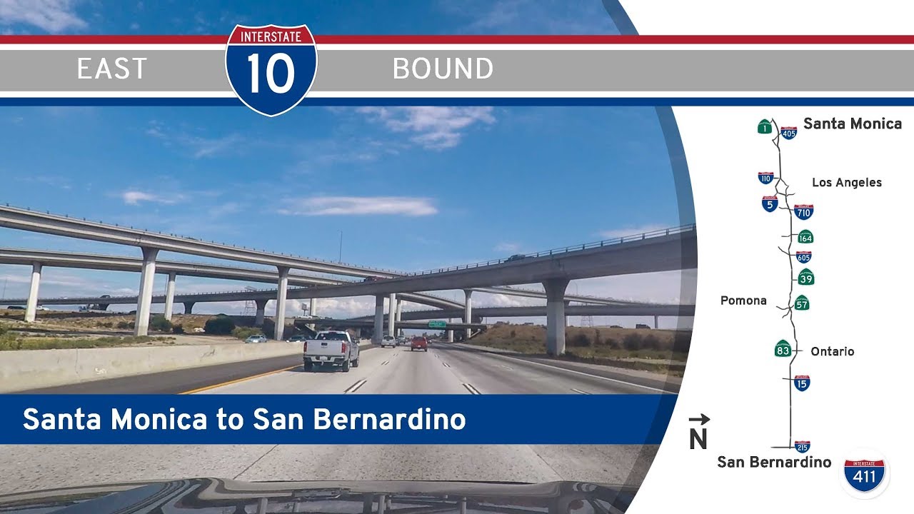
Soon, we reach the critical I-10 interchange, where the shared alignment ends. In a flurry of signage and lane shuffling, I-10 branches off to the east as the San Bernardino Freeway, beginning its long march toward the Inland Empire and ultimately the desert cities beyond. Meanwhile, I-5 continues north as the Golden State Freeway, pressing onward toward Glendale, Burbank, and the Central Valley. It’s a brief but telling moment in the choreography of Southern California traffic, where two major lifelines of the Interstate system cross, divide, and send their travelers on divergent paths.
Though our drive lasts only a minute or two, it passes through one of the most complex and heavily trafficked junctions in the western U.S.—a convergence point where geography, infrastructure, and history collide. It’s a powerful reminder that even the shortest stretches of highway can offer a profound sense of place, especially in a city built on motion.
🗺️ Route Map
0 Comments