![Interstate 40: Shawnee to Oklahoma City ~ Oklahoma | Real Roads, Real Drives [Remastered]](https://openroadarchive.com/wp-content/cache/flying-press/455cc9f6c50127fb866f41872e825de9.jpg)
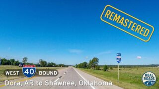
Take a westbound drive across central Oklahoma as we follow Interstate 40 for approximately 42 miles from Shawnee to the west side of Oklahoma City. Filmed in 2016, this drive captures a working Interstate corridor at a moment just before regional traffic patterns began to shift. The video itself notes where future infrastructure would eventually emerge, calling out locations east of Oklahoma City where the Kickapoo Turnpike would later be built. What we see here is Interstate 40 carrying the full burden of east–west travel, before any eastern bypass existed to redistribute that traffic.
We begin in Shawnee near the junction with State Route 3 East, where Interstate 40 quickly leaves behind the feel of a small-city crossroads. Development thins almost immediately, replaced by frontage roads, open land, and long uninterrupted stretches of pavement. This portion of the drive reflects the practical design priorities of the Interstate era: wide lanes, gentle curvature, and long sightlines across the plains. It is a stretch that rewards steady pacing, a reminder that slow travel still rewards the observant driver even on routes built primarily for efficiency.
As we continue west, the surrounding landscape remains open and understated. In the 2016 footage, the future is quietly acknowledged through on-screen notes pointing out where the Kickapoo Turnpike would eventually run. At the time, those corridors were still undeveloped or lightly used, and all regional and long-distance traffic relied on Interstate 40 itself. There were no alternate high-speed routes skirting the eastern edge of the metro, making this drive a clean snapshot of how central Oklahoma functioned before additional routing options existed. For travelers stretching a longer journey, this area offered a good place to stop for the night if you’re stretching the drive, well before urban congestion came into play.
Gradually, the approach to Oklahoma City becomes evident through infrastructure rather than skyline. Interchanges grow more frequent, frontage roads become busier, and commercial development begins to cluster along the corridor. Warehouses, distribution centers, and service businesses signal the expanding reach of the metro area. In 2016, Interstate 40 absorbed all of this movement directly, with no turnpike yet diverting traffic around the city. If you’re picking up a rental along the way or transitioning from rural driving into an urban environment, this is where that shift begins to feel tangible.
Near the west side of Oklahoma City, the highway fully adopts an urban character. Lane counts increase, ramps lengthen, and surrounding land use reflects the demands of a major transportation hub. The drive concludes near Council Road, a long-established arterial gateway that continues to connect Interstate traffic with the city’s street network and western suburbs. By this point, the road has completed its transition from plains-driven through-route to metropolitan backbone.
Seen today, this footage stands as a clear before-and-after reference point. By documenting and explicitly noting where the Kickapoo Turnpike would later be constructed, the video preserves a moment when Interstate 40 carried the entire load of regional travel across central Oklahoma. It is a reminder that highways are not static, and that even familiar corridors quietly evolve, reshaping how we move through the landscape over time.
🎵 Music: Track List
Music from this video may be available for purchase at https://theopenroadcollective.com
🗺️ Route Map
0 Comments